Visit Las Vegas
Meetings & Conventions
Travel Professionals
Destination Marketing
Advertising Campaigns
Sales & Marketing Initiatives
Signature Events
Transportation Development
Advocacy
Lightning Round
Research
Press & Publicity
Who We Are
Mission, Vision, Values
Board of Directors
Board Meeting Schedule & Minutes
Schedule & Minutes Archive
Leadership Team
Home
Who We Are
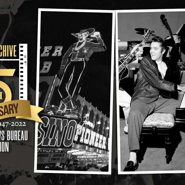
Las Vegas Strip Aerial Photographs Through the Years
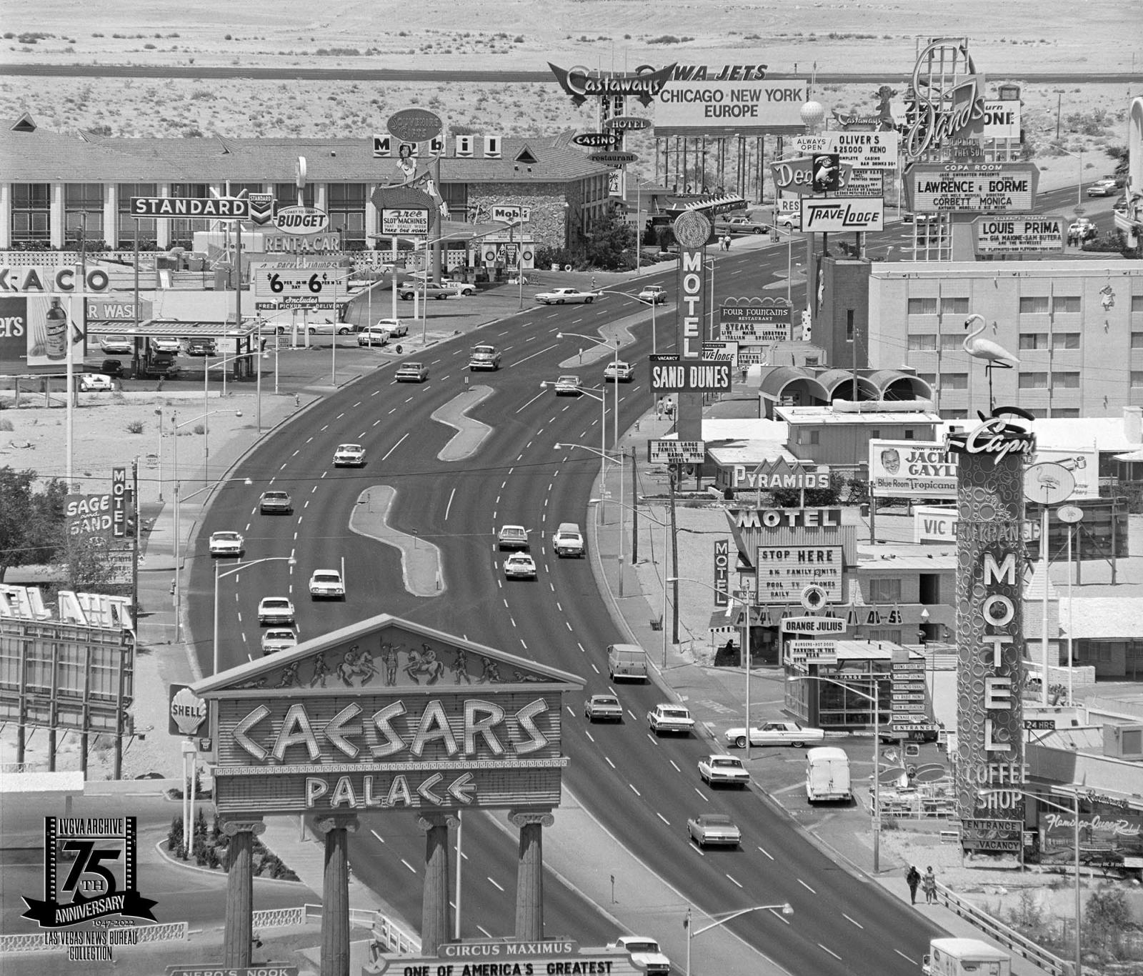
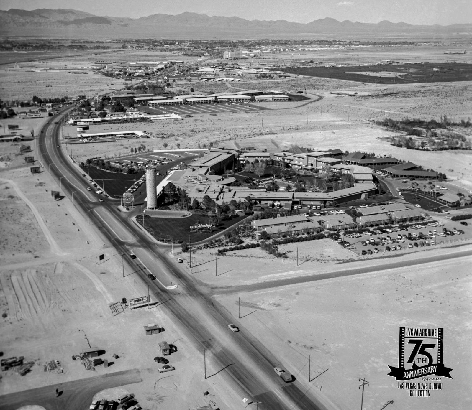
An aerial of the Las Vegas Strip looking north on July 25, 1967. On the left is: Caesars Palace, a Texaco, Budget Rental Car, Mobil, Castaways, and a Denny's. On the right is: the Flamingo, Orange Julius, Pyramids Motel, Motel Sand Dunes, Travelodge, Four Fountains Restaurant, and the Sands.
An aerial showcasing the Las Vegas Strip looking north, circa 1958. The triangular 'roads' to the west of the Strip were actually runways at McCarran Field, now the Harry Reid International Airport.
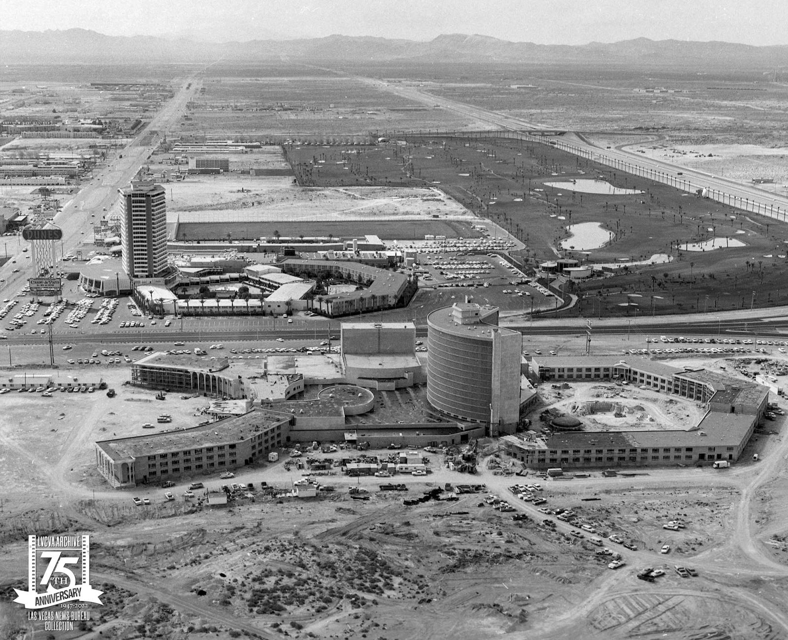
An aerial of the Las Vegas Strip looking south with the nearly completed Caesars Palace and the Dunes with its golf course behind it on March 25, 1966. Caesars Palace opened on August 5, 1966, by Jay Sarno. Sarno was involved in the design and insisted on a oval shape. He declared, 'Over the years that I have been creating hotels, I've discovered that the oval is a magic shape...conducive to relaxation.'
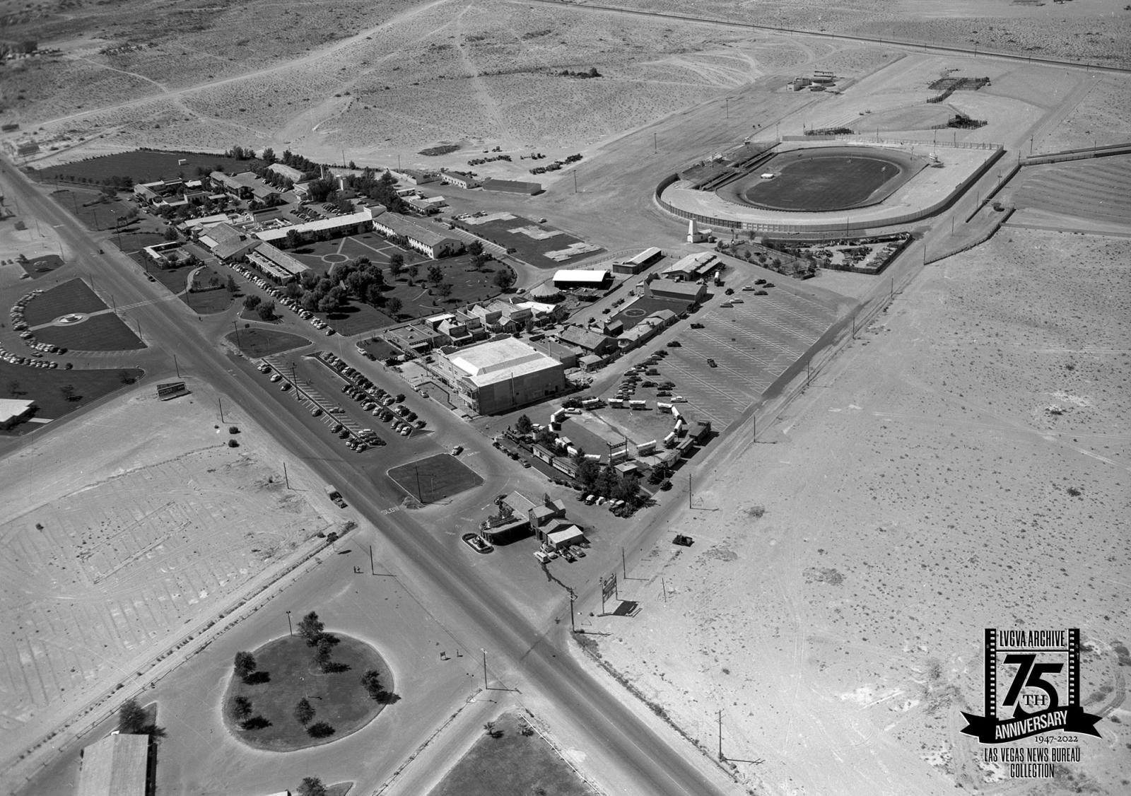
The Last Frontier (upper left), Frontier Village, Silver Slipper, and Sportsdrome Track, circa 1953. The Sportsdrome Track was the first paved track, which opened in 1946 and closed in 1957, it featured midget car races, jalopy races, and rodeos.
An aerial of the Las Vegas Strip looking north with the Flamingo in the foreground and Riviera in the background on April 4, 1955. The Riviera opened a few days later on April 20, 1955.
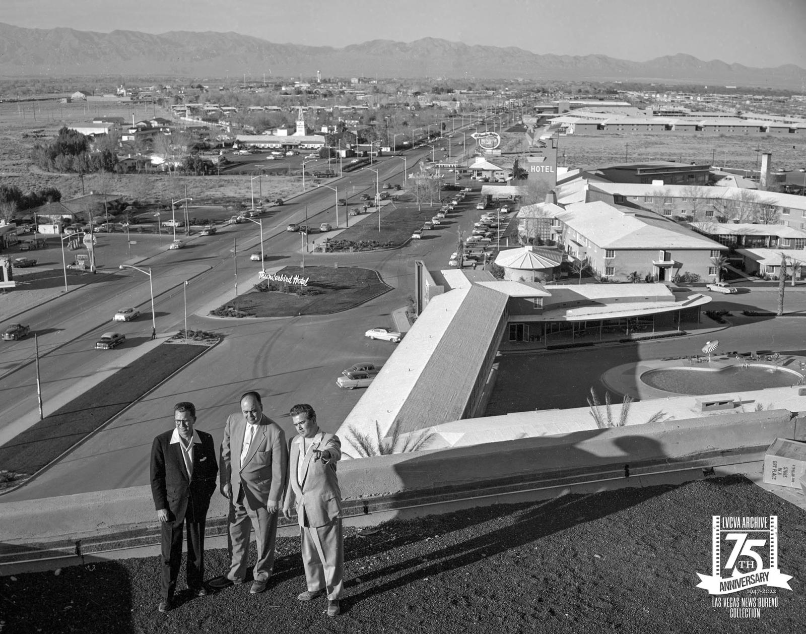
An aerial of the Las Vegas Strip looking north, taken from the top of the Riviera on May 8, 1955. The Thunderbird, El Rancho Vegas, and Sahara are visible.
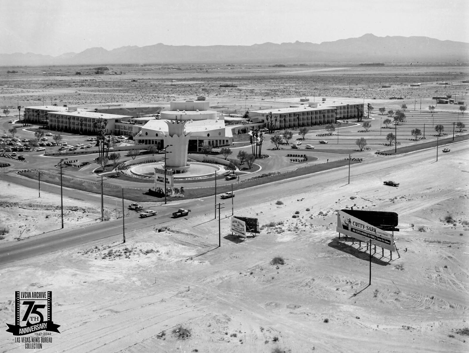
An aerial of the Tropicana, looking southeast on May 4, 1957. Harry Reid International Airport is located in the empty land that was behind the hotel. The Tropicana opened in 1957, and the New York Times declared that it, 'was Las Vegas's only world class luxury resort' built for a record $15 million.
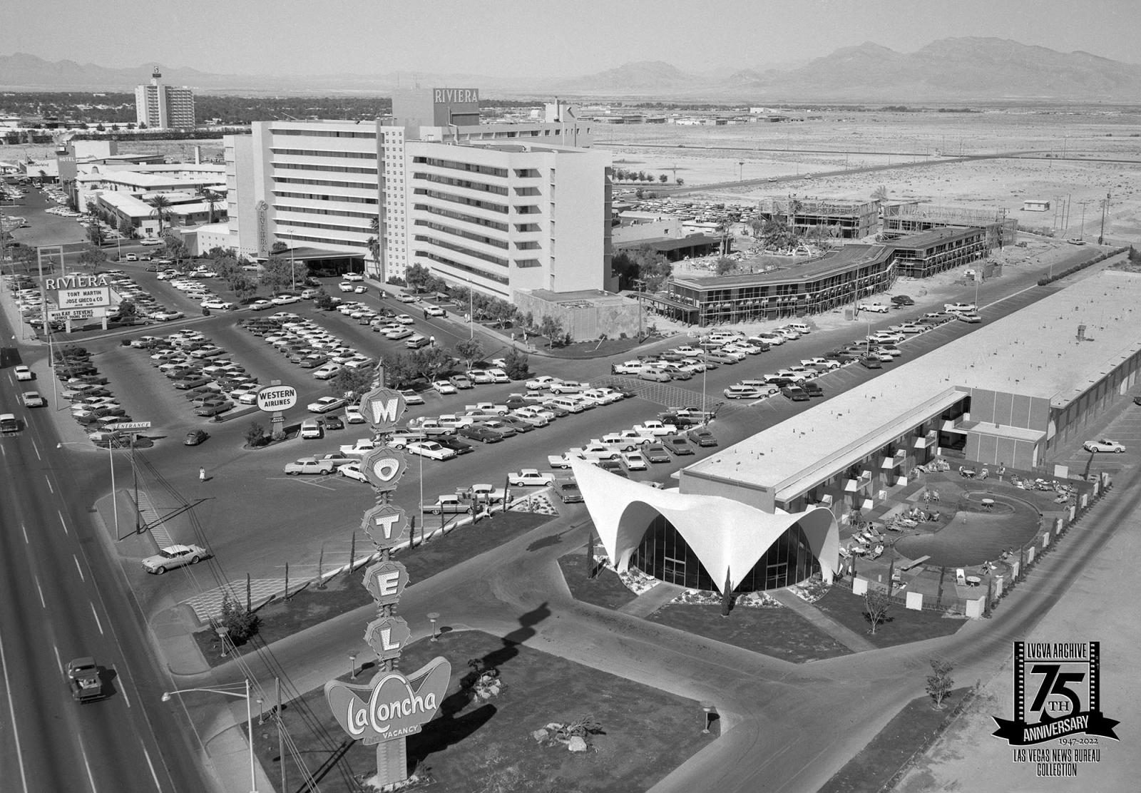
The La Concha, Riviera, Thunderbird, and a distant Sahara are visible in this aerial taken of the Las Vegas Strip looking north on April 21, 1962. The La Concha lobby has been restored and relocated to the Neon Museum where it functions as their lobby and gift shop.
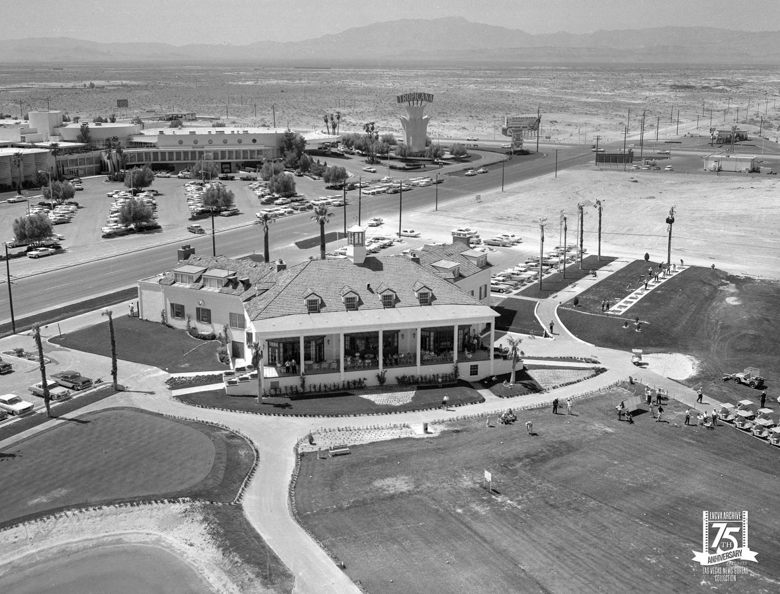
An aerial of the Tropicana Country Club and the Tropicana looking west on April 12, 1962. This was before the construction of the I-15. The Tropicana Country Club opened in 1961 on 125 acres of land, across the street from the hotel.
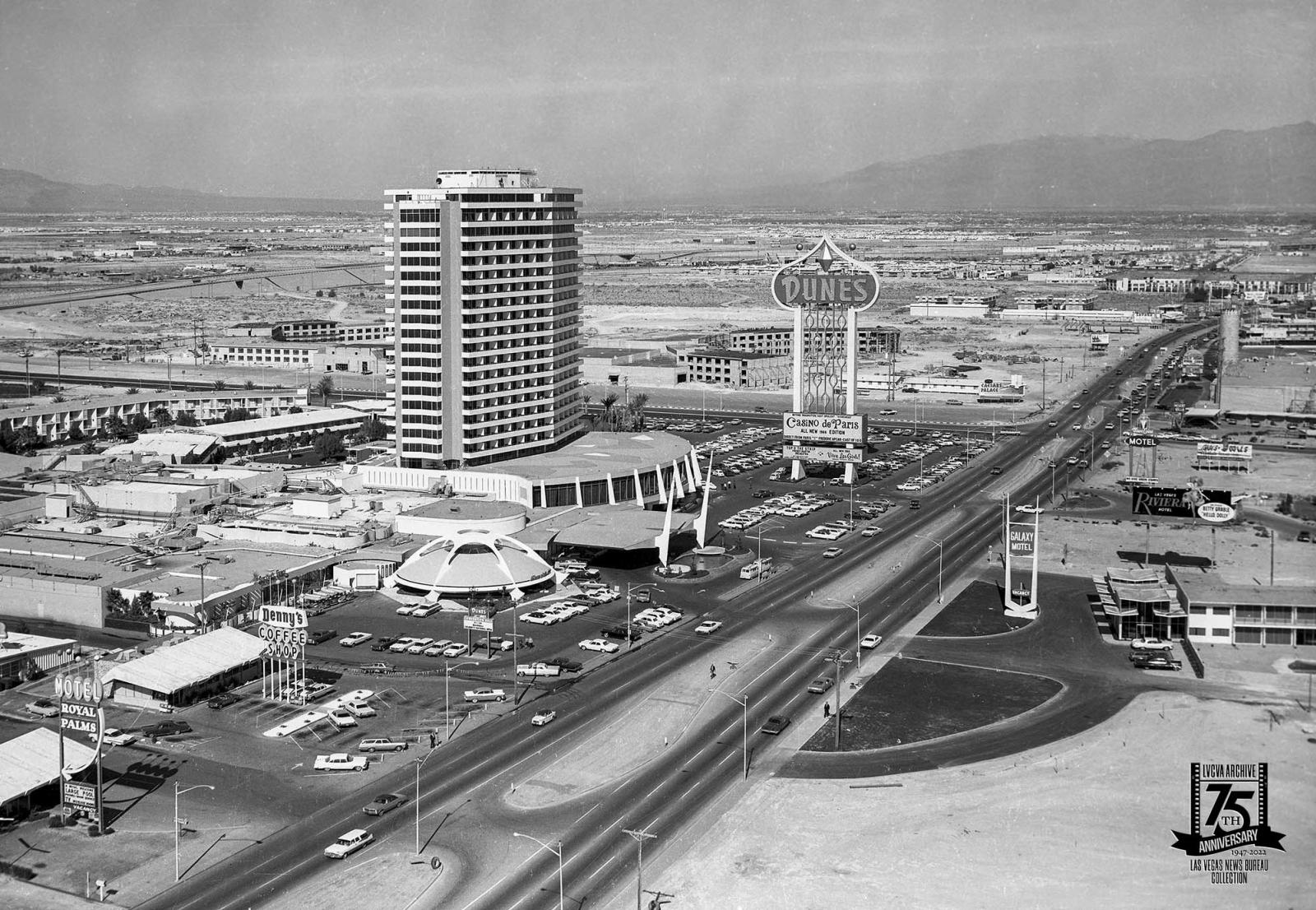
An aerial of the Las Vegas Strip looking north with the Hotel Royal Palms, a Denny's, and the Dunes on February 11, 1966. Behind the Dunes, which is now the Bellagio, you can see the construction for Caesars Palace.
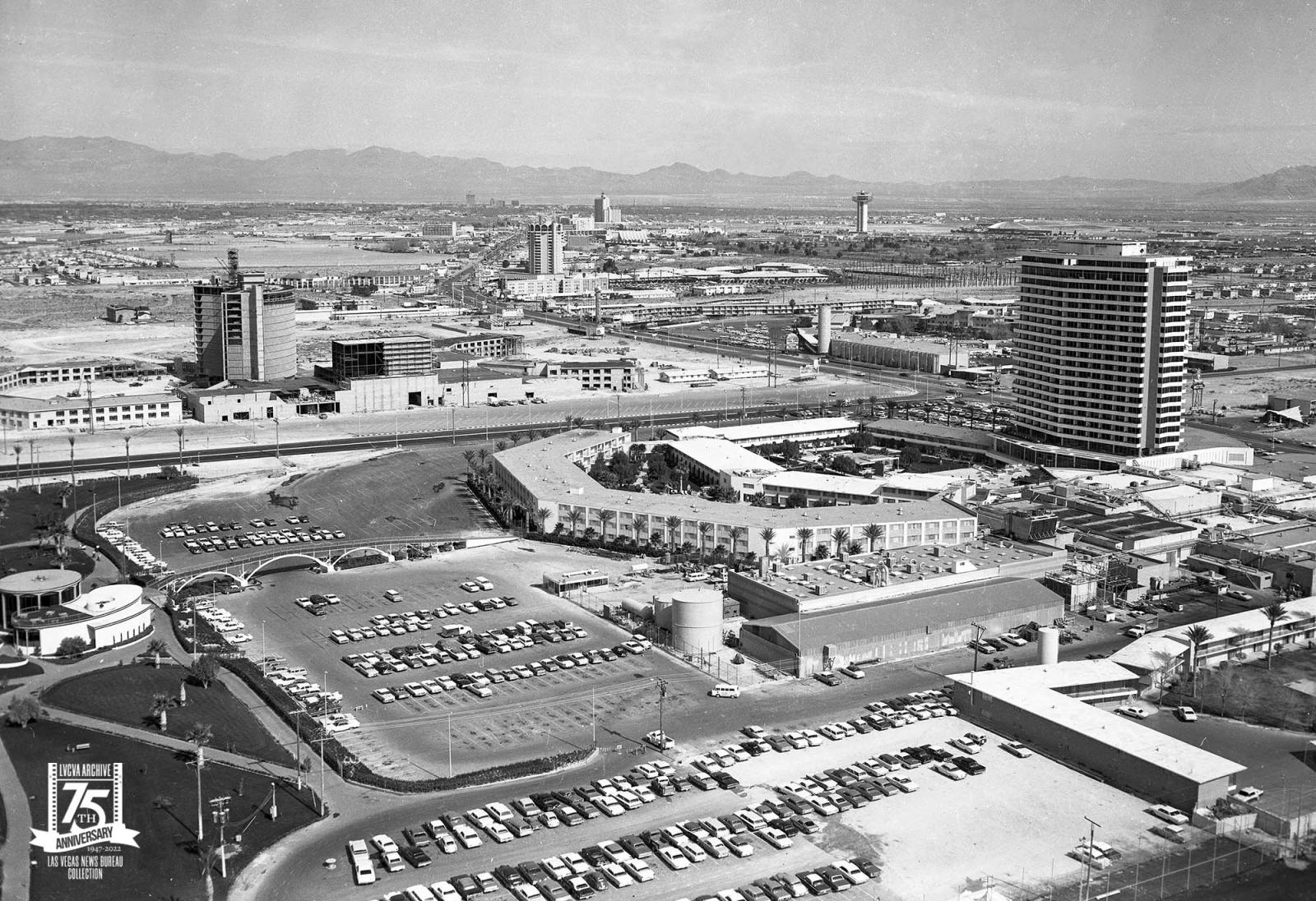
An aerial of the Las Vegas Strip looking northeast on February 11, 1966. The Dunes is the large building in the center, which is now the Bellagio. Caesars Palace is under construction with the Flamingo across the street and the Sands to the north. The Venetian and Palazzo now stand where the Sands was.
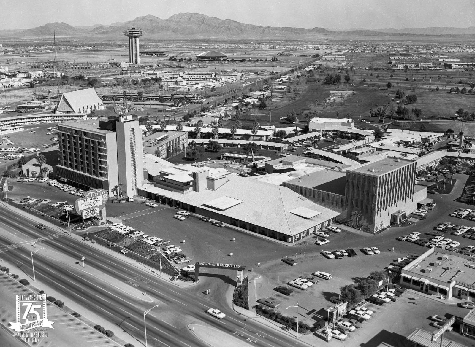
An aerial of Wilbur Clark's Desert Inn and its golf course, looking east on February 11, 1966. In the background is the Landmark and Las Vegas Convention Center.
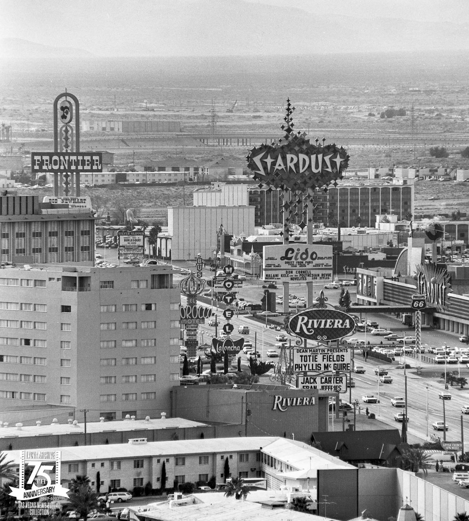
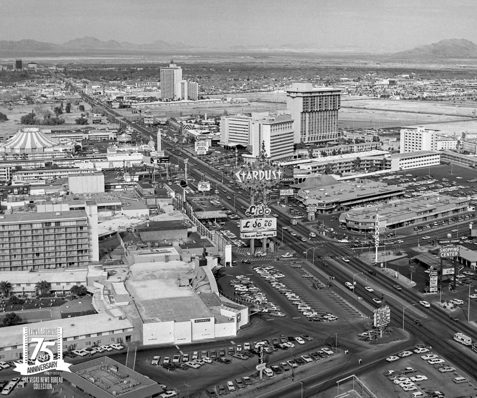
An aerial of the Las Vegas Strip looking southwest on December 11, 1969. The Riviera, Stardust, Silver Slipper, and Frontier are the major properties that are visible. The Stardust marquee was 188-feet tall and was the tallest freestanding sign in the world.
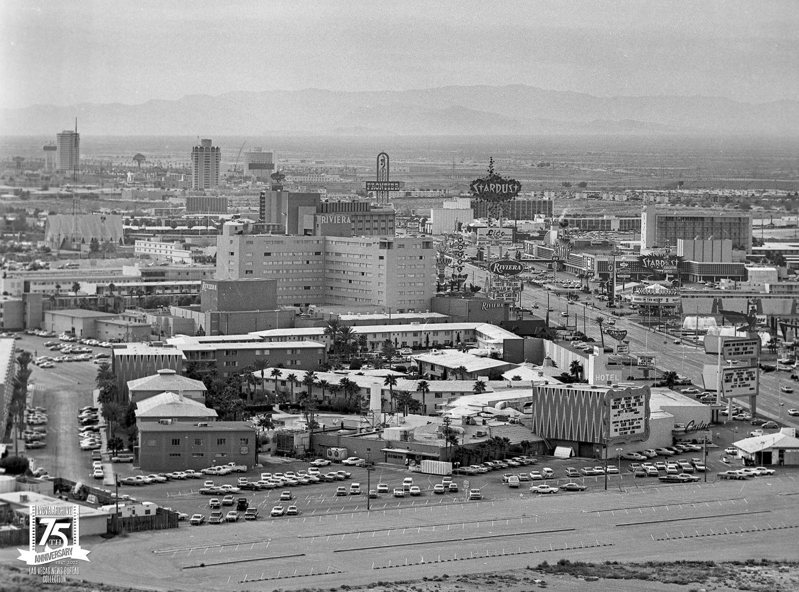
An aerial of the Las Vegas Strip looking north on February 25, 1975. The Stardust is in the foreground with the Sahara tower in the background.
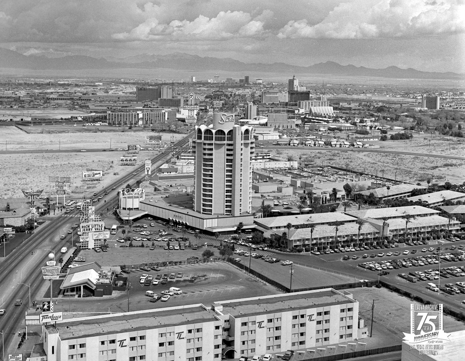
An aerial of the Sands looking north on March 3, 1975. Downtown Las Vegas is visible in the distance. The marquee for the Sands is advertising a show for Rich Little and Jerry Vale.
Load More
Looking for higher-quality images? Fill out a
formal image request
.
Back
to top